 The largest park in the region, the Sooke Hills provides a buffer to Greater Victoria Water Supply Catchment and includes Mount Braden which at (471m) is one of the highest peaks in the CRD Regional Parks system. The Sooke Hills Wilderness Trail within the park is part of the Trans Canada Trail route. This park consists of two separate land areas located on either side of the Goldstream catchment. The north section opened in 2017, and the south section opened late 2020.
Features
- Sooke Hills Wilderness Trail (forms part of the Trans Canada Trail) video
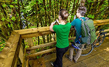
- Goldstream River suspension bridge time-lapse video
- Viewing platform at Waugh Creek Falls
- Peaceful forest scenes and hilltop vistas
Trail Rating:
Challenging - not suitable for all ages and abilities
Size: 4090 ha
Location: Langford and Juan de Fuca Electoral Area
Established: 2017
Hours: Sunrise to Sunset
Things to Do
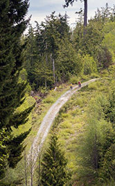
 Sooke Hills Wilderness Trail offers outstanding hiking and cycling, and in some sections, horseback riding, that spans rivers, forests and hilltops.
Note: The Sooke Hills Wilderness Trail is challenging and is not an all ages and abilities route.
The 13km unpaved trail offers a unique wilderness experience as it travels through remote areas and wildlife habitat. The trail lies between the Humpback Reservoir in Sooke Hills Wilderness Regional Park and the Capital Regional District-Cowichan Valley Regional District boundary. Sooke Hills Wilderness Trail provides part of both the Trans Canada Trail and the Vancouver Island Spine Trail routes.
The Sooke Hills Wilderness Trail provides an opportunity to connect with nature; to experience and benefit from this natural landscape. The trail travels through both open areas and sheltered woodlands.
Rest at the viewing platform, 2.5km from the Humpback trailhead, to take in the sights and sounds of Waugh Creek Falls, which flows forcefully in the winter and spring. From there, it is 0.5km to the suspension bridge across the Goldstream River.
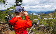
 The hilltop vistas of the surrounding mountains and Finlayson Arm are spectacular in the northern section. There are views of Greater Victoria in the distance. The views are the reward for the effort made to reach the top!
Equestrians are permitted on the north end of the trail, from the Cowichan Valley Regional District-Capital Regional District boundary southwards for 4km.
There are steep grades up to 16%, narrow sections and rocky, gravel surfaces along the route. Hike and ride within your limits and on sections of the trail suitable to your skill level. This is a shared-use trail, please watch for other users and travel at safe speeds.
South Section
If you climb to the top of Mount Braden or scramble up Sugarloaf, you will see green hills stretching in every direction. The same park connectivity that benefits far-roaming wildlife allows hikers, cyclists and equestrians the opportunity to access other protected areas. From this park, you can travel to Sea to Sea Regional Park, Sooke Mountain Provincial Park, and Mount Wells Regional Park. With multiple summits, long distance trails, and connectivity to other parks, countless adventures can start from this location.
Amenities
There are three toilets, two parking lots, a viewing platform and suspension bridge.
How to Get There
By vehicle from Victoria to North Section
Follow the Trans-Canada Highway from Victoria, and turn left on West Shore Parkway. At the roundabout, continue straight to stay on Westshore Pkwy. Turn right onto Meridian Ave. Turn left onto Irwin Rd, stay left at Humpback Rd. Destination is on the right.
By vehicle from Victoria to South Section
Follow the Trans-Canada Highway from Victoria, and turn left on West Shore Parkway. At the roundabout, continue straight to stay on Westshore Pkwy. Turn right onto Juan De Fuca Hwy/Sooke Rd/BC-14 W. Destination is on the right.
By vehicle from Shawnigan Lake to north trail head
There is no CRD parking lot at the north trail head. A Cowichan Valley Regional District parking lot for the Cowichan Valley Trail is located on Sooke Lake Road in Shawnigan Lake. Follow the trail south for 9kms where it joins to the Sooke Hills Wilderness Trail north trail head.
By bike or foot from Victoria to south trail head
Follow the Galloping Goose Regional Trail that begins at Harbour Road in Victoria for approximately 15 km. Follow the “Trans Canada Trail” signage in the City of Langford to Sooke Hills Wilderness Regional Park on Humpback Road. Two parking lots provide access to Sooke Hills Wilderness and Mount Wells Regional Parks.
By bike or foot from Shawnigan Lake to north trail head
Follow the Cowichan Valley Trail – Malahat Connector south from the Sooke Lake Road entrance for approximately 9km, where it joins Sooke Hills Wilderness Trail north trail head.